File:Maps- Branches vs Loops - 4.jpg
Jump to navigation
Jump to search

Size of this preview: 602 × 599 pixels. Other resolutions: 241 × 240 pixels | 3,800 × 3,784 pixels.
Original file (3,800 × 3,784 pixels, file size: 1.61 MB, MIME type: image/jpeg)
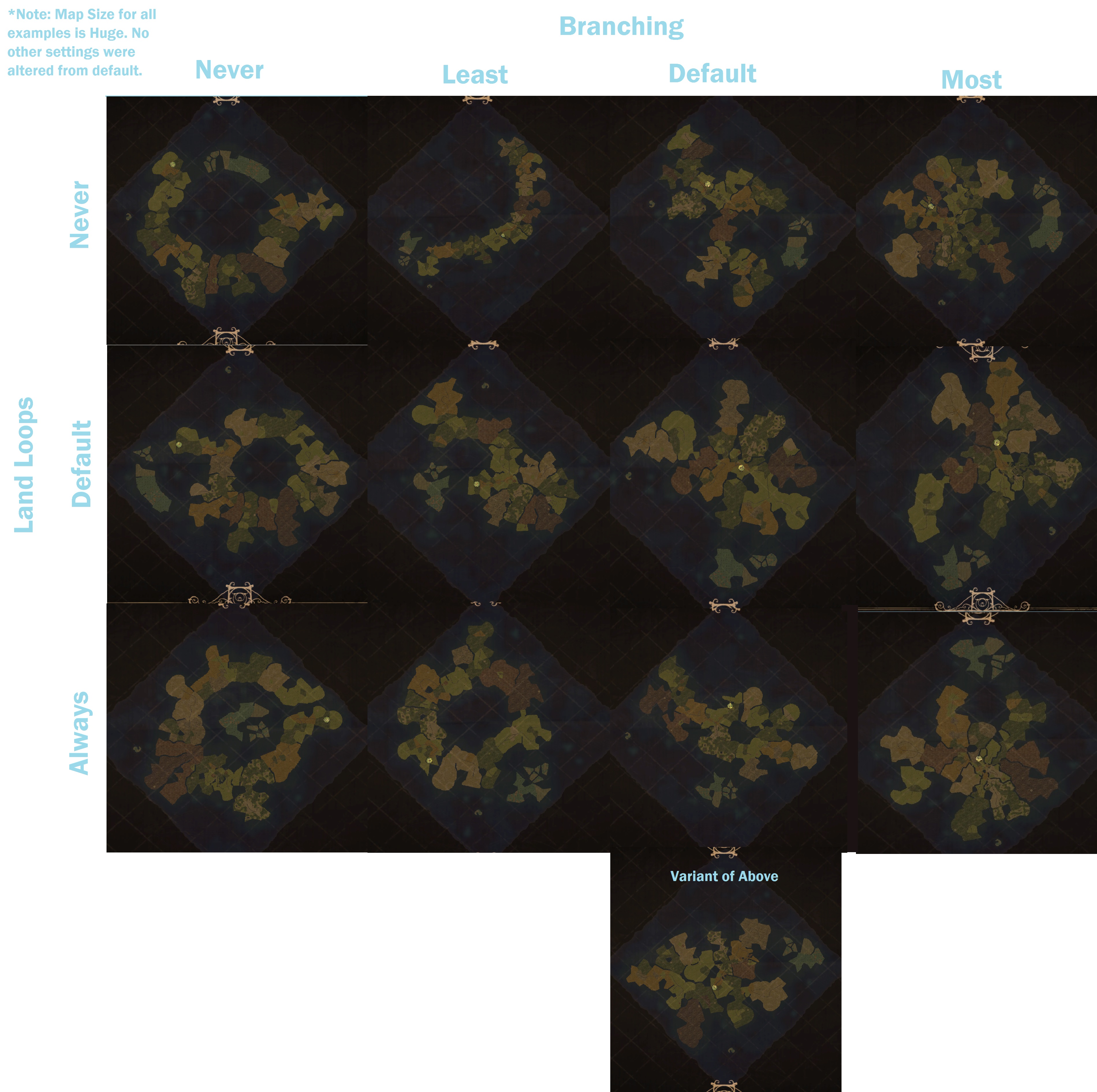
Chart depicting examples of maps generated with each possible combination of land looping options and branching options.
File history
Click on a date/time to view the file as it appeared at that time.
| Date/Time | Thumbnail | Dimensions | User | Comment | |
|---|---|---|---|---|---|
| current | 07:32, 28 July 2023 | | 3,800 × 3,784 (1.61 MB) | S.Remedy (talk | contribs) |
You cannot overwrite this file.
File usage
The following page uses this file: